
Snow in Peterborough: Weather warnings in place for rain and snow in the city this evening
The new year has arrived with a week of bad weather for Peterborough – and it is forecast to continue this evening (Thursday, January 8.)
Two weather warnings are in place for Peterborough tonight – one for rain, and one for snow.
Both yellow warnings, issued by the Met Office, are set to come into force at roughly the same time – the snow warning is in place from 5pm today, while the rain warning starts at 6pm.
Given the rain may have an impact on the snow – or vice versa – The Peterborough Telegraph asked the Met Office what the weather forecast is for Peterborough – and whether snow will settle in the city.
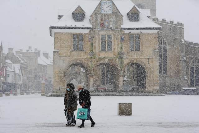

And while it is good news for drivers – those hoping for a snowball fight, or the chance to build a snowman may be disappointed.
A spokesperson said: “One element to consider is the timing, with rain expected to move in from the west initially, before turning to snow later. The focus of significant snow and accumulations is further west, in Wales and the Midlands. In your area any snow that does fall is likely to be very wet and may not settle.,
“That said, the boundary is very finely balanced and small changes in temperature and precipitation intensity could lead to snow rather than rain, so it is still possible you may see some snow, albeit the more notable snow still most likely further west.”
What the warnings say:
The snow warning is in place from 5pm on January 8 until noon on January 9.
The warning says: “Rain, associated with Storm Goretti, will spread northeastwards across the warning area through Thursday afternoon and evening, transitioning to snow fairly widely overnight and into Friday. Snow initially will begin to accumulate across hills in Wales and then increasingly to lower levels overnight. Whilst not all areas may see accumulating snow, accumulations of 5-10 cm are likely quite widely, with scope for 15-25 cm in places, especially on some hills above 200 metres elevation. There is a chance of 30 cm accumulating over high ground in Wales and/or the Peak District. “There is some uncertainty over the exact track of Storm Goretti, which will influence the locations most likely to see disruptive snow. Amounts of snow will also depend quite heavily on both elevation and the intensity of precipitation, and as this becomes somewhat lighter into Friday this will lead to an awkward mix of rain, sleet and snow, gradually clearing away to the east. Therefore there is likely to be a lot of variation, even over relatively short distances. “The low pressure system has been named by Meteo France, as the strongest winds associated with Storm Goretti are most likely over northern France.”
The rain warning is in place from 6pm on January 8 until 9pm on Friday, January 9.
The warning says: “Outbreaks of rain will arrive from the south on Thursday evening then persist overnight and through Friday, heavy at times, before slowly easing during Friday evening. 20-30 mm rainfall is likely quite widely, with a small chance of 40-60 mm in a few places, leading to the chance of some flooding and disruption. In addition, rain may turn to sleet or wet snow at times which may lead to some accumulations in places, more especially over inland parts of Lincolnshire. “Strong winds, especially near coasts, will be an additional hazard with winds gusting 40-50 mph at times and leading to large waves through Friday.”