
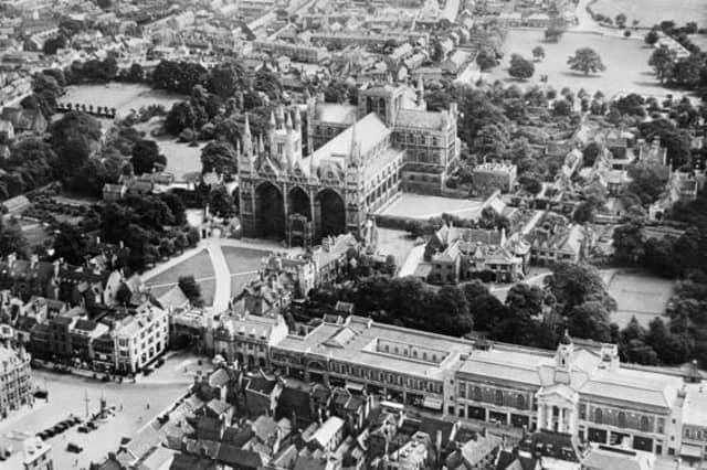

Historic England has launched a new online tool making over 400,000 aerial photographs of the East of England over the past 100 years available to view online for the first time.
The Aerial Photography Explorer allows users to search and explore an online map revealing aerial photographs of the East of England from 1919 to the present day.
The aerial imagery offers a fascinating insight into the development and expansion of Peterborough and Cambridgeshire’s urban and rural areas.
Photographs of the Cambridgeshire area include views of the 2014 flooding of the Great Ouse river over Fen Drayton, buried archeological ditches in Conington and the earthworks of a medieval village within the grounds of Childerley Hall.
The online tool covers major areas of the East of England - including Bedfordshire, Cambridgeshire, Norfolk and Essex.
300,000 of the aerial photographs in the collection are the work of Historic England’s Aerial Investigation and Mapping team - the remaining 100,000 images come from the Historic England Archive aerial photography collection.
Tony Calladine, East of England Regional Director, Historic England said: “I am delighted that our new online tool will allow people to browse our wonderful collection of historic aerial photos that my team uses every day to unlock the mysteries of England’s past.
“The remarkable pictures of the East of England give a fascinating insight into our local areas, allowing people to see how their street and their town centre looked when their great grandparents lived there.”
Nigel Huddleston MP, Minister for Heritage, said: "What better way to discover our shared history than through this fascinating new online tool which offers a bird's eye view of our past.
“I can't wait to discover more about my local area and encourage everyone to explore the thousands of English sites from the last century."
Over the coming years, Historic England aims to expand the platform - as more of the six million aerial images in the Historic England Archive are digitised.
To access the aerial photographs, visit: https://HistoricEngland.org.uk/AerialPhotos
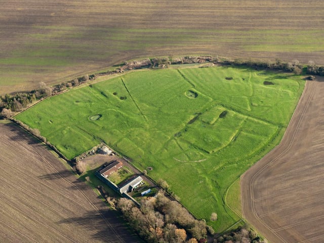
5. Childerley, Cambridgeshire
Winter sunshine picks out the earthworks of a medieval village situated within the grounds of Childerley Hall. The houses of the villagers would have sat on the rectangular earthwork platforms with hollow ways providing routes through the settlement. The parallel ridges and furrows around the village are the result of ox-drawn ploughs used in the same fields over many years. The settlement was probably abandoned in the 16th century. (Photo: Historic England) Photo: Historic England
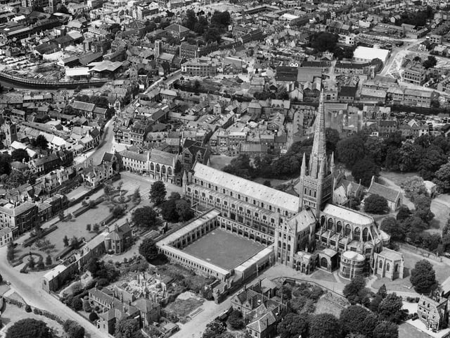
6. Norwich Cathedral (1946)
Construction of Norwich Cathedral started in 1096. These aerial views show the cathedral in its close in 1946 having survived bombing during one of the so-called ‘Beideker raids’ in June 1942 which targeted historic towns and cities in Britain. During this raid incendiary bombs fell through the chancel roof, causing numerous fires, the last of which was finally extinguished after 14 hours, and the cathedral saved. (Photo: Historic England) Photo: Historic England
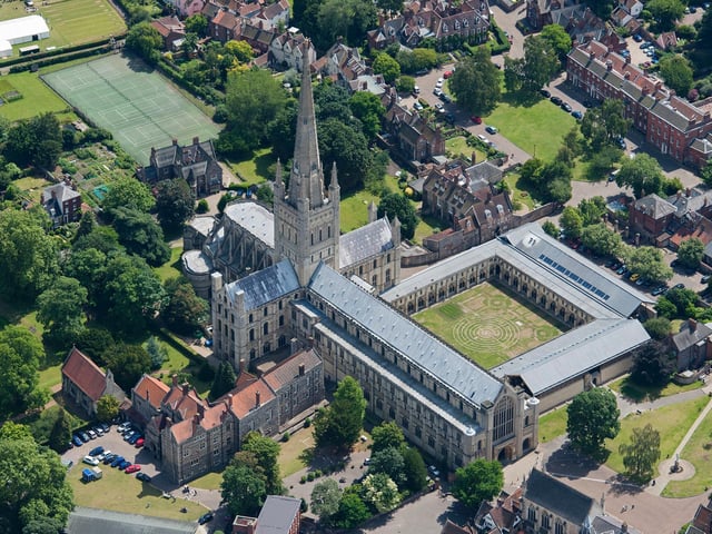
7. Norwich Cathedral (2014)
This second image of Norwich Cathedral shows the cathedral in 2014, with strange pattern in the grass in the cloister. These marks are not buried archaeology, but marks left by the set of the film Tulip Fever. Photo: Historic England
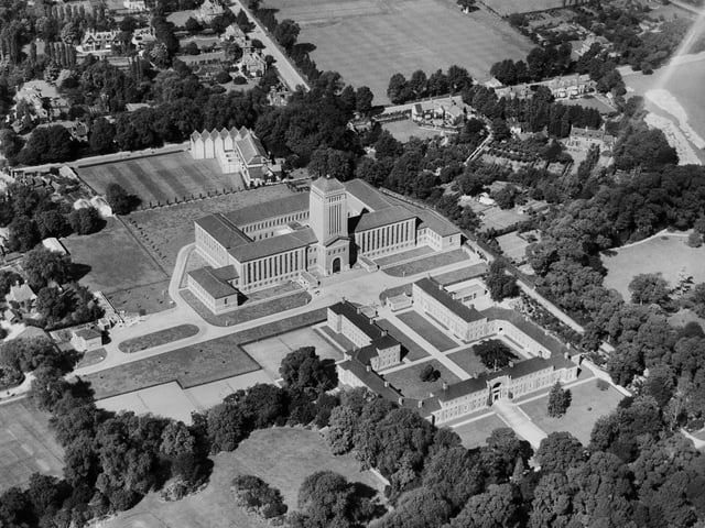
8. Cambridge University Library
Old and new views of Cambridge University Library. The building was constructed between 1931-1934 by Giles Gilbert Scott. Though it has been extended to over the years, the outward appearance of this distinctive grade II listed building remains unchanged. (Photo: Historic England) Photo: Historic England