
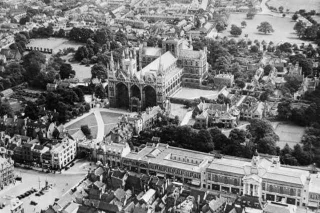

Historic England has launched a new online tool making over 400,000 aerial photographs of the East of England over the past 100 years available to view online for the first time.
The Aerial Photography Explorer allows users to search and explore an online map revealing aerial photographs of the East of England from 1919 to the present day.
The aerial imagery offers a fascinating insight into the development and expansion of Peterborough and Cambridgeshire’s urban and rural areas.
Photographs of the Cambridgeshire area include views of the 2014 flooding of the Great Ouse river over Fen Drayton, buried archeological ditches in Conington and the earthworks of a medieval village within the grounds of Childerley Hall.
The online tool covers major areas of the East of England - including Bedfordshire, Cambridgeshire, Norfolk and Essex.
300,000 of the aerial photographs in the collection are the work of Historic England’s Aerial Investigation and Mapping team - the remaining 100,000 images come from the Historic England Archive aerial photography collection.
Tony Calladine, East of England Regional Director, Historic England said: “I am delighted that our new online tool will allow people to browse our wonderful collection of historic aerial photos that my team uses every day to unlock the mysteries of England’s past.
“The remarkable pictures of the East of England give a fascinating insight into our local areas, allowing people to see how their street and their town centre looked when their great grandparents lived there.”
Nigel Huddleston MP, Minister for Heritage, said: "What better way to discover our shared history than through this fascinating new online tool which offers a bird's eye view of our past.
“I can't wait to discover more about my local area and encourage everyone to explore the thousands of English sites from the last century."
Over the coming years, Historic England aims to expand the platform - as more of the six million aerial images in the Historic England Archive are digitised.
To access the aerial photographs, visit: https://HistoricEngland.org.uk/AerialPhotos
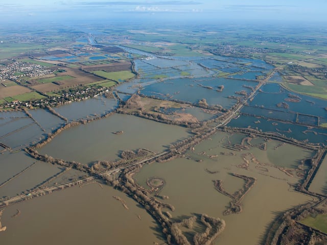
1. Fen Drayton, Cambridgeshire
View of 2014 flooding of the Great Ouse River over Fen Drayton looking northeast towards Holywell. The isolated circular mound of a round barrow, a Bronze Age burial site, is visible surrounded by the flood waters in the foreground. (Photo: Historic England) Photo: Historic England
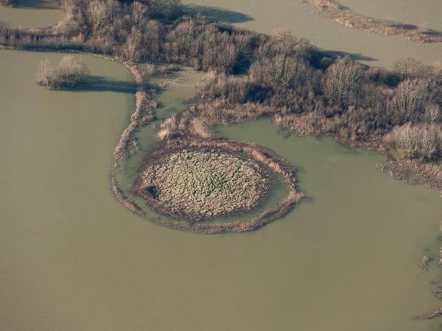
2. Fen Drayton, Cambridgeshire
View of 2014 flooding of the Great Ouse River over Fen Drayton looking northeast towards Holywell. The isolated circular mound of a round barrow, a Bronze Age burial site, is visible surrounded by the flood waters in the foreground. (Photo: Historic England) Photo: Historic England
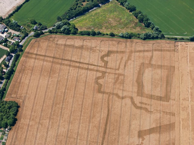
3. Bassingbourn, Cambridgeshire
The bold cropmarks mark the site of an important medieval centre originally belonging to the de Bassingbourn family from the 12th century. The origins of the site are thought to be a motte castle inside a rectangular moat. It was probably the site of a manor house and in the 15th century an ornate garden was developed, perhaps by the Tiptoft family, Earls of Worcester, after which the site seems to have fallen out of use. The site is called John O’Gaunt’s House but is unlikely to have any direct association with the 14th century prince. (Photo: Historic England) Photo: Historic England
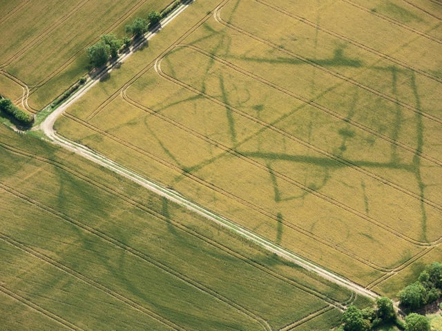
4. Conington, Cambridgeshire
In an average summer the clay soils in this part of Cambridgeshire keep hold of moisture and the crops grow evenly. However, in exceptionally dry weather, as in 2011, the ground dries out and the crops grow differently depending on the depth of soil. This means that buried archaeological ditches are revealed as differences in the height and colour of the crop. This process revealed the buried ditches defining this complicated arrangement of enclosures. The different shapes of the enclosures can indicate different phases or uses. The ‘D’ shaped enclosure with an entrance gap to the right is typical of the Iron Age but it is likely that what we can see developed over a long period, perhaps from the later Bronze Age through to the Roman period. (Photo: Historic England) Photo: Historic England