
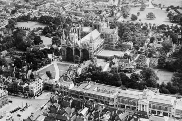

Historic England has launched a new online tool making over 400,000 aerial photographs of the East of England over the past 100 years available to view online for the first time.
The Aerial Photography Explorer allows users to search and explore an online map revealing aerial photographs of the East of England from 1919 to the present day.
The aerial imagery offers a fascinating insight into the development and expansion of Peterborough and Cambridgeshire’s urban and rural areas.
Photographs of the Cambridgeshire area include views of the 2014 flooding of the Great Ouse river over Fen Drayton, buried archeological ditches in Conington and the earthworks of a medieval village within the grounds of Childerley Hall.
The online tool covers major areas of the East of England - including Bedfordshire, Cambridgeshire, Norfolk and Essex.
300,000 of the aerial photographs in the collection are the work of Historic England’s Aerial Investigation and Mapping team - the remaining 100,000 images come from the Historic England Archive aerial photography collection.
Tony Calladine, East of England Regional Director, Historic England said: “I am delighted that our new online tool will allow people to browse our wonderful collection of historic aerial photos that my team uses every day to unlock the mysteries of England’s past.
“The remarkable pictures of the East of England give a fascinating insight into our local areas, allowing people to see how their street and their town centre looked when their great grandparents lived there.”
Nigel Huddleston MP, Minister for Heritage, said: "What better way to discover our shared history than through this fascinating new online tool which offers a bird's eye view of our past.
“I can't wait to discover more about my local area and encourage everyone to explore the thousands of English sites from the last century."
Over the coming years, Historic England aims to expand the platform - as more of the six million aerial images in the Historic England Archive are digitised.
To access the aerial photographs, visit: https://HistoricEngland.org.uk/AerialPhotos
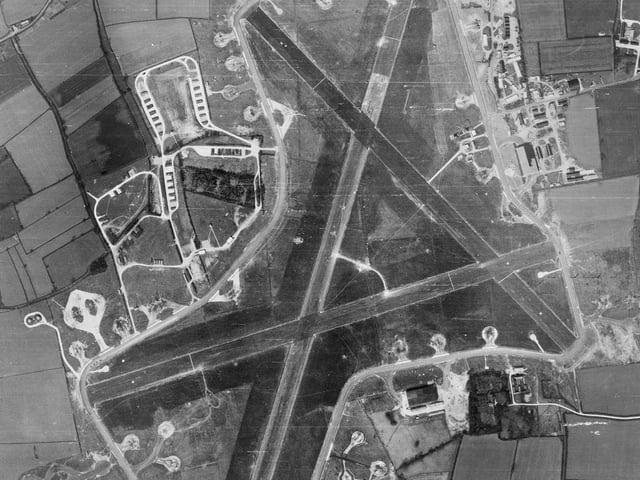
13. Tibbenham airfield, Norfolk
A Second World War airfield built on top of a First World War landing ground. The second phase of the airfield lasted from 1942 until 1959. It is one of many airfields built in East Anglia for operations over Europe by the Allied forces featuring the distinctive pattern of three intersecting runways. There are buildings, accommodation and hard standings for planes dispersed around the perimeter road to minimise danger from aerial attack. (Photo: Historic England) Photo: Historic England
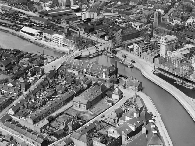
14. Stoke Bridge Wharf, Ipswich
Photograph of the Stoke Bridge Wharf, Ipswich taken in May 1933. The port of Ipswich has been a centre of trade since the Saxon period. The warehouses, railway siding and boast indicate the importance of the port as a commercial centre. (Photo: Historic England) Photo: Historic England
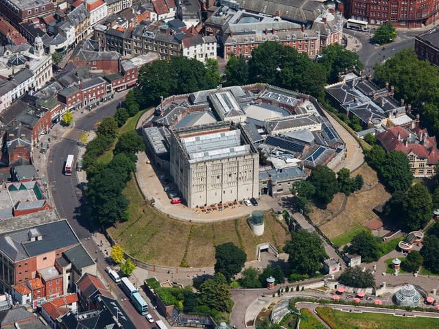
15. Norwich Castle
Norwich’s imposing castle has been a striking landmark since Norman times. Believed to have originated as a motte and bailey built between 1066 and 1075. the keep is thought to have been built about 1095 to 1110. Drum towers and a gatehouse were added in the 13th century. The castle was held by the Parliamentarians during the Civil War and the keep used as a prison 1789-1795. Other buildings were added around 1824 and the site became a museum in 1894. (Photo: Historic England) Photo: Historic England