

The first aerial shot was taken in 1996 but if one was taken today, from the same spot, the view would look very different.
The land shown here became Peterborough’s southern township of Hampton. Work started in 1996 and today there are thousands of homes and other amenities.
Do you recognise the rest of the images from the air of Peterborough through the years?
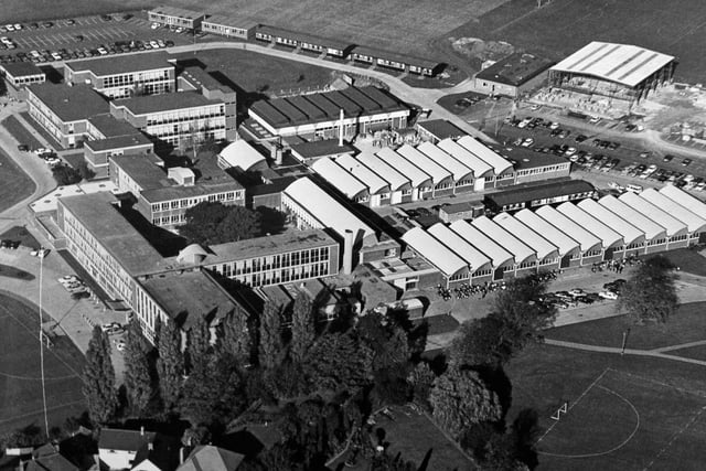
1.
This is a photograph showing the site of Peterborough Regional College. It was taken in 1980. I wonder how many Peterborough students have passed through its doors since it was established in 1946 as Peterborough Technical College?
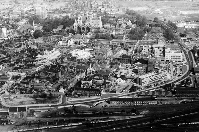
2.
Here’s a magnificient shot of the city centre which was taken sometime in the 1970s pre Queensgate.
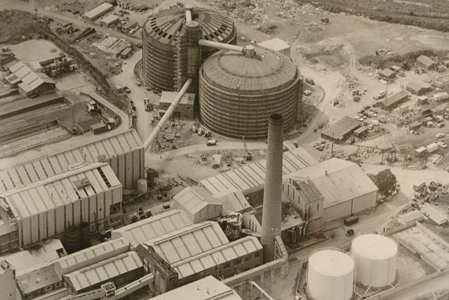
3.
The sprawling British Sugar site in Oundle Road was one of Peterborough’s key industrial sites for many years. It was also – rightly or wrongly – blamed for the notorious Peterborough Pong that residents used to complain about during the sugar beet season. The factory opened in 1926 and closed in 1991.The land in Woodston has been redeveloped with housing and other amenities and the firm’s link to the area will last with the estate known as Sugar Way. British Sugar retains strong links with the city and the company’s headquarters is now in Hampton. Photo: Midlands
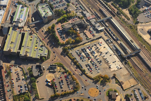
4.
This picture shows an area of the city centre which has been earmarked for massive redevelopment. So this view could look very different in a few years’ time. You can see Queensgate and its car parks and also the railway station. The bottom left quarter of t e picture shows the North Westgate area which has long been talked about for a multi-million development. There are also plans for the area around the station and the Great Northern Hotel. Photo: Midlands