
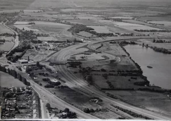

The first aerial shot was taken in 1996 but if one was taken today, from the same spot, the view would look very different.
The land shown here became Peterborough’s southern township of Hampton. Work started in 1996 and today there are thousands of homes and other amenities.
Do you recognise the rest of the images from the air of Peterborough through the years?
5.
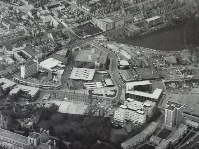
I wonder if anybody can date this picture of the city centre? The area has changed significantly but paradoxically remains very recognisable . There are several clues – it was taken before the Central Library was built on Broadway next to the old Sheltons building and the Hereward Cross Centre was in place. Other landmarks are St Mary’s flats, the Passport Office and, in the middle of the picture, the market. The recently demolished Northminster car park can be seen, although Bayard Place had not yet been built. Photo: Peterborough Evening Telegraph
6.
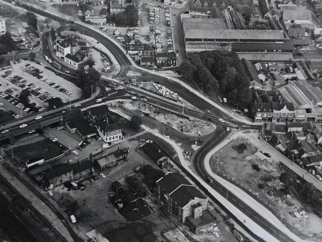
This is a splendid aerial photograph of Peterborough city centre showing work progressing on what would become the main route through the city, Bourges Boulevard. You can see the top end of Cowgate and, on the opposite side of the picture, Crescent Bridge. Work on the Queensgate centre has not yet begun and the old Perkins factory is still in place. Photo: Midlands
7.
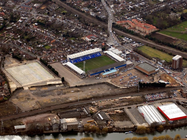
Here’s a great shot of the south bank and beyond with Posh’s ground dominating the centre.The stadium has changed much since this picture was taken with the addition of a new stand. Between the ground and the river many new houses and flats have been built. And, of course, the river bank is undergoing a huge transformation with the massive Fletton Quays development. I’m not sure of the exact date of the picture but it is prior to 2009 as the Green Back Yard next to Apex House is not yet in place.