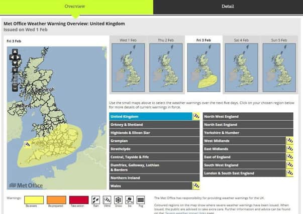
Met office issues yellow weather warning for high and potentially damaging winds across county this Friday


There is the potential for gales to affect southern parts of England and Wales on Friday, February 3. The most likely scenario is for gusts widely in the 50 to 60 mph bracket, which could affect travel and produce some minor damage.
A Met Office spokesman added: “Gusts of 60 to 70 mph may still occur, whilst there remains a small chance of 80 mph gusts in exposed coastal areas. If such winds were to happen, we would expect damage to trees and perhaps to buildings, possible disruption to power supplies, as well as delayed travel.
Advertisement
Hide AdAdvertisement
Hide Ad“Spells of wet and windy weather will be affecting many areas later this week and over the weekend, with surface water issues an additional hazard.”
The Met Office has not yet designated the front a storm name, the next would be Storm Doris, as it is not thought to be large enough at this time.