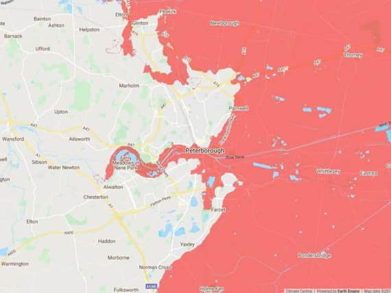
New study suggests Peterborough to be underwater by 2100


While Peterborough and its surrounding areas are currently landlocked, the city could end up as a coastal resort.
The image shows the extent of the issues of the rising sea level could cause. Taking these images into account, this prediction is based around the assumption that there are no cuts to emissions.
Advertisement
Hide AdAdvertisement
Hide AdThe report reads: “Improved elevation data indicate far greater global threats from sea level rise and coastal flooding than previously thought.”
Ben Strauss, CEO of Climate Central said: “Sea level rise is one of the most serious problems of the 21st century. We can reduce its threat considerably by swiftly and deeply cutting pollution and transitioning to climate-cleaner forms of energy, agriculture and land use. But we have already heated the planet enough to assure that the sea will continue to rise, at least slowly, for centuries to come.”
You can see directly how your street will be affected by zooming in on the map here.