Peterborough residents urged to only travel if necessary tomorrow as Storm Eunice set to batter city with wind speeds potentially reaching 75mph
and live on Freeview channel 276
The Met Office have issued an amber weather warning for much of England and Wales - including Peterborough - for tomorrow when the storm arrives.
Yesterday Storm Dudley hit causing some travel disruption - but Eunice is forecast to bring stronger winds and cause more disruption.
Advertisement
Hide AdAdvertisement
Hide AdThe Met Office have warned that flying debris caused by the winds could result in ‘a danger to life.’
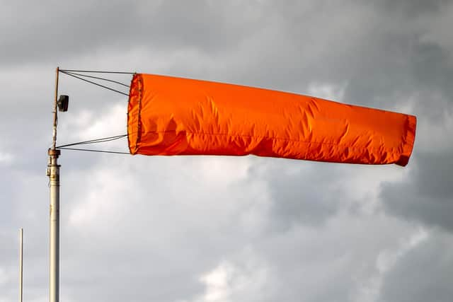

The weather warning is in place from 3am until 9pm, with the worst of the weather forcaset to hit Peterborough from lunchtime and through the afternoon.
Today LNER, which runs some train services from Peterborough - said; “London North Eastern Railway (LNER) is advising customers of expected disruption to services due to anticipated extreme weather conditions as a result of Storms Dudley and Eunice over the next few days.
Advertisement
Hide AdAdvertisement
Hide Ad“Customers are asked to check in advance of their journeys as a reduced timetable will be in place across parts of the LNER route on Friday 18 February 2022.
“People who are booked to travel in either direction between York and London King’s Cross or Leeds and London King’s Cross are being advised not to travel on Friday but where possible, make their journey today, Thursday 17 February.
“Alternatively, customers can request a full refund from their point of purchase.
“Network Rail has introduced speed restrictions on the East Coast route with possible damage to infrastructure as a result of the anticipated conditions. The Met Office has issued an extreme weather warning with high winds forecast with central and southern England expected to be most impacted by Storm Eunice.
Advertisement
Hide AdAdvertisement
Hide Ad“Services that can operate face extended journey times, and short notice delays, alterations and cancellations are expected. Warrick Dent, LNER Safety and Operations Director, said: “We are encouraging our customers with tickets dated for Friday 18 February to bring forward their travel arrangements to Thursday 17 February where possible.
“We expect services to be extremely busy in the coming days and advise customers to check our website and social media channels for the latest information.”
Matt Stacey, Head of Stations at East Midlands Railway - who also runs services from Peterborough - said: “We strongly advise customers who need to make a journey with us in the next few days to choose Thursday or Saturday. The strength of Storm Eunice will mean that on Friday there is likely to be widespread disruption to services across the country’s rail network.
“However, we understand that not everyone can rearrange their travel plans and customers may still need to travel by rail. If this is the case, we suggest customers leave themselves plenty of extra time to reach their destination.”
Advertisement
Hide AdAdvertisement
Hide AdGary Walsh, East Midlands Route Director for Network Rail, said: “Running a railway through extreme weather is always a challenge. We have extra workers out on the network at key locations, ready to react quickly to Storm Eunice and keep passengers moving wherever it’s safe to do so. As the weather worsens, some journeys may take longer, so I’d advise passengers to check before travelling and allow plenty of time.”
Trevor Robbins-Pratt from Peterborough Weather Watch, said there was still some uncertainty about what the weather would bring tomorrow - but there would be strong winds.
He said; “At the moment, it is looking like there is gust potential of between 50mph to 75mph in places across Peterborough.
“Peak gusts are currently looking to be from around midday, through the afternoon, into and through early evening. “The named area of Low Pressure (LP) is slated to zip West to East through Friday, with its centre set to run just to the North of the area, meaning we would be in the swathe of strong gusts to the S/SW of the area of LP as it tracks Eastward through the afternoon/early evening.
Advertisement
Hide AdAdvertisement
Hide Ad“If the track of the LP is a little further North, then gust potential is even higher than the values I have already suggested. Conversely, if the track is South of our area, then gust potential would be lower.”
Peterborough City Council have said there are currently no plans to change any services in the city tomorrow.
Cambridgeshire Fire and Rescue Service has issued advice ahead of tomorrow.
A spokesman said; “Only travel if you need to. “If you do go out, please take extra care driving and allow more time than usual for your journeys. “Drive to the conditions and be aware of debris on the roads, and be cautious when passing high-sided vehicles on open roads.
Advertisement
Hide AdAdvertisement
Hide Ad“Make sure everything is secure in your garden, by ensuring loose items outside (furniture, toys, trampolines) are moved into a shed/garage or secured down to prevent them blowing away or getting damaged.
“Businesses, please check outside areas for unsecured items, like seating, umbrellas, gazebos. “If you are out and about, please be careful of falling debris.
“Report fallen trees to the relevant organisation. Check who is responsible on our website- https://www.cambsfire.gov.uk/community-safety/be-prepared-for-an-emergency/severe-weather/strong-winds