


There is little doubt that amateur aerial photography is hugely popular these days.
Indeed, huge moves forward in digital tech and considerable reductions in the cost of recreational drones means almost anyone can try their hand at it.
Despite what some people may think though – and, yes we’re looking at you, Gen-Z – drone photography has not been around for that long.
In fact, the first truly modern recreational drones with cameras were only developed in the early 2000s.
And even then, these new-fangled hover cameras didn’t really hit mainstream commercial markets until a good few years after that.
Of course, the concept of aerial photography has been around for far longer.
However, the bulk of old-school, non-digital cameras, combined with the very real logistical (and economic) challenges of getting them airborne ensured the output of aerial photos remained relatively modest during the last century.
Naturally, this makes any aerial photos we have from the decades before drones something of a rarity – as well as a treat.
With that in mind, we have quite a treat in store for you today.
In conjunction with our good friends at Peterborough Images, we have managed to source and identify some truly wonderful aerial images of Peterborough from each decade of the 20th century.
We don’t know how these shots were taken; we are assuming the fearless snappers wangled a trip in a helicopter, balloon or plane – or scaled an incredibly high structure – in order to marvel at and consequently capture the scenes below.
What we do know is the images they took are nothing short of sensational, providing valuable individual points of reference and recording a catalogue of posterity snapshots to mark how much our city has changed over the years.
Our journey begins in the 1990s, when Brotherhoods was still a place of work and ‘retail parks’ were few and far between.
We will then take you back through each decade until we reach the 1900s – a time when photography was still in its infancy, and helicopters and airplanes were, understandably, pretty thin on the ground.
So, put your feet up, stick your phone on silent, and fly back with us through the decades as we show you how Peterborough changed in the decades before drones.
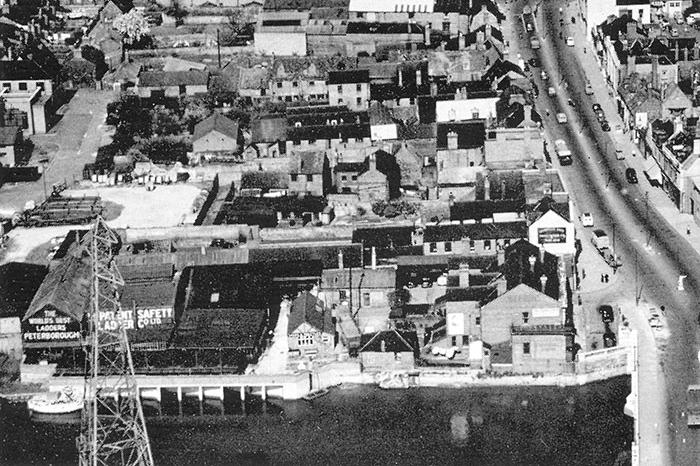
5. Peterborough from above in the decades before drones
1950s. This thought-provoking photo from the 1950s shows what we now know as Rivergate west of Bridge Street, which you can see running along the right-hand side of the shot. Photo: Peterborough Images Archive
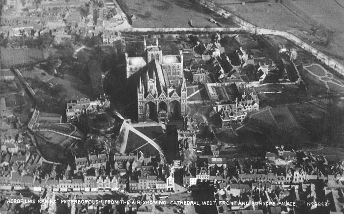
6. Peterborough from above in the decades before drones
1940s. A lovely photo showing the layout of Bridge Street at the bottom along with the broadly recognisable road structure around the side and back of the Cathedral grounds. Our research suggests this photo dates from 1947 but we'd be happy to hear from anyone who may know better... Photo: Peterborough Images Archive
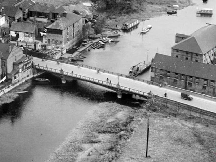
7. Peterborough from above in the decades before drones
1930s. A detailed aerial shot of the old Town Bridge taken shortly before the current Town Bridge was built in the early 1930s (1934?). Photo: Peterborough Images Archive
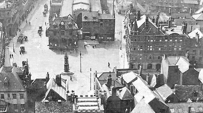
8. Peterborough from above in the decades before drones
1910s? This superb early aerial shot shows an instantly recognisable Market Square and surrounding buildings. Our best guess - mostly attributed to the presence of motor vehicles - is that this image may have been taken between 1910-20. Please do get in touch if you think we're wrong. Photo: Peterborough Images Archive