
Civic Pride: Take a walk... it's all mapped out
Peterborough Civic Society is always keen to promote our city, its people, places, history, buildings and activity, writes Toby Wood.
Of course we’re not the only ones. The excellent Peterborough Positive has been in the forefront of devising and developing a free city centre map and, more recently, a Street Art map showing many of brilliant murals commissioned by the organisation and installed by Nathan Murdoch, Tony Nero and the Street Art team. More about Peterborough Positive in next month’s column!

However there are even more people and organisations who are keen to promote Peterborough and what it has to offer.
Recently the Civic Society’s Derek Brown and myself have been working with Joanne Rose, a Hereward Community Rail Partnership officer, to devise walking maps for those visiting Peterborough city centre.
The HCRP is a community-based organisation that promotes rail travel within a designated region, which is funded by the train operating companies - Greater Anglia, CrossCountry, LNER and East Midland Railway along with
Fenland District Council and Cambridgeshire County Council.
The intention is to encourage more people from Whittlesea, March, Manea, Ely and Cambridge to increasingly use the train, especially to travel to Peterborough. (Note that the railway companies spell it Whittlesea instead of
Whittlesey – I’m not sure of the difference). I’m told that historically it was spelt either Whittlesey or Whittlesea but only the station is now called Whittlesea.
Hereward CRP secured the funding for this project from CrossCountry Trains Community Engagement Fund. The train operator are keen to promote Peterborough as a destination and promote local walking and cycling routes and the use of the train for integrated and sustainable journeys.
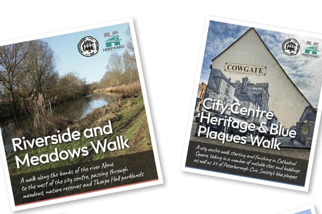
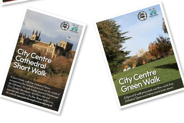
So, what are these walking maps and who are they for? The four walking maps routes range from the short, just over a mile, to quite long – nearly six miles. The shortest walk is a gentle stroll from Cathedral Square around the Cathedral precinct and back again, the longest one goes from the city centre, to the river and along the northern bank to Thorpe Meadows, Thorpe Hall and back again – a walk for those owning stout shoes!
The City Centre Heritage & Blue Plaques Walk is perhaps the most complex and rich in terms of built-environment content. Followers of the walk will be taken to look at many of the city’s iconic buildings as well as twenty-four of the Society’s blue plaques. The walk is nearly three miles long and could easily end at one of the increasing number of cafes and bars in and around Cathedral Square.
The City Centre Short Walk is specifically designed for those residents and visitors who may not consider themselves walkers per se – the walk ambles around the outside of the Cathedral, taking in some of the lesser known city centre features. Believe it or not there is peace and tranquillity metres away from Cathedral Square and
many of the places are completely unknown to locals yet alone visitors to the city.
The City Centre Green Walk is a figure-of-8 walk that encompasses places as rich as Minster Precincts, the Embankment, Bishop’s Road Gardens, Stanley Park, Broadway cemetery and Central Park. The walk is proof that there are so many green spaces and peaceful nooks and crannies within easy walking distance of the city centre.
Just have a look online at an aerial view of the city and you may be amazed at the amount of green spaces Peterborough possesses.
The fourth walk, entitled Riverside and Meadows Walk is perhaps the most demanding, one of those walks that requires ‘sensible footwear’. The walker passes Railworld and is encouraged to notice much of the railway’s old Victorian cast iron bridges near the river itself. The walk is five and a half miles long and takes in the banks of the river Nene, Thorpe Meadows, Thorpe Hall, birthplace of many a Peterborian (including myself) when it was used as the city’s maternity unit between 1943 and 1970. The walker meanders through parkland and meadows near the river floodplain where, if you’re really lucky, you might spot a kingfisher. Occasionally the route can be adversely affected by bad weather conditions or a swollen river but there are alternatives. Common sense is needed. There’s plenty to see and it really is amazing that there is so much peace and tranquillity just a few hundred metres from the busy city centre.
Peterborough city centre gets its fair share of criticism, some occasionally justified but much as a result of some long-held and unjustified prejudices. These new maps, along with other material that has been recently produced goes a long way to dispelling the ‘there’s nothing to do here’ myth. We in the Civic Society will continue to walk round the city centre, stop, look up, down and around and take photographs to help promote the city. If you ever see one of us wandering through the city centre doing just that, please feel free to tap us on the shoulder and have a chat!
The four HCRP/Civic Society maps are available for free, from the Town Hall Tourist Information Office, Peterborough Museum or the Cathedral. Alternatively you can download any of the maps from the Peterborough Civic Society or HCRP website or the Walking and Cycling section of the HCRP website www.herewardcrp.org/events-and-activities/category/outdoor-activities/