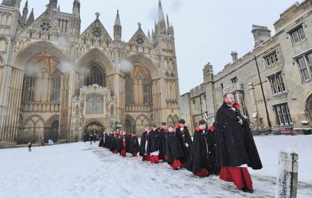
The Peterborough Triangle - why city avoids snow disruption


It has left many weather observers scratching their heads in vain. For, when the snow falls across the country and other folk can barely get out of their front doors for mounds of the stuff, why does Peterborough seem to miss out?
Rail travellers journeying north and south on the East Coast Main Line are often bemused to find that the snow only seems to settle on and beyond the city’s boundaries.
Advertisement
Hide AdAdvertisement
Hide AdBut that feeling of the city missing out on its share of the snow is held up by the facts. The answer is the Peterborough triangle.
Quite simply, the city lies so low the snow melts before it reaches the ground.
And the Met Office has released a map showing how many days of snowfall each area of the UK gets - and a white patch in the middle of a large area of blue signified the lack of winter weather in the region.
Trevor Robbins-Pratt, from Peterborough Weather Watch, said he believed the reason for the lack of snow was the geography of the city.
Advertisement
Hide AdAdvertisement
Hide AdHe said: “Peterborough lies very low, only a few metres above the sea level, and I think that is the reason we don’t get too much snow here.
“I’ve been here since 1993, and it has been the same every year.
“I call it the Peterborough triangle. Whenever the national forecasts predict a number of inches of snow, I always know to reduce that, or that it will not settle.
“It is also the same with the amount of rain we get as well - we are much drier, even than places like Stamford and Grantham which are not that far away.
Advertisement
Hide AdAdvertisement
Hide Ad“Because we are just 10-15m above sea level, the freezing level for rain and snow is much higher. This means that when snow falls, it has more chance to melt before it hits the ground.
“Peterborough’s freezing level could be at 1,000 feet, while somewhere not too far away could only be at 200 feet, giving the snow much more chance to fall.
“The end of January and beginning of February is the most likely time for snow to fall here, rather than December, so there is still a chance we could get some more snow this winter.”
Dan Williams, a forecaster at the Met Office said Peterborough’s location in the south of the country also reduced the chances of snow falling. He said: “The UK averages 23 days of sleet and snow every year, but in Cambridgeshire that is only at nine days.
“The snow generally comes in off either the west/north west coast or the north east coast. Peterborough is probably too far south to be affected by this.”